NOVA IMS Patent Redefines Drone-Based Measurement
NOVA IMS Patent Redefines Drone-Based Measurement
Detalhe da Notícia
With an innovative approach that bypasses the need for GPS or complex systems, NOVA IMS introduces a practical and accurate method for measuring heights and dimensions using drones, opening up new applications in fields like border security, environmental monitoring, and precision agriculture.
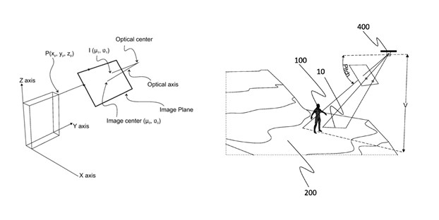
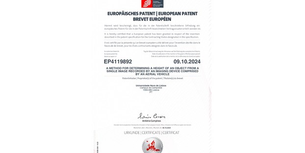
NOVA Information Management School (NOVA IMS) has registered a patent that promises to redefine the use of drones for real-world height and dimension measurements. This new method enables precise measurement from a single drone image, without relying on GPS or advanced positioning systems. With this patent, NOVA IMS places itself at the forefront of aerial measurement technology, offering a practical, efficient, and accessible solution.

A New Vision for Aerial Measurement and Mapping
Developed by NOVA IMS faculty members Marco Painho and Mauro Castelli, together with MagIC researcher Andrea Tonini, the patented technology uses simple visual references—such as lines or known-sized objects in an image—to calculate height and dimensions with high accuracy. Instead of requiring advanced GPS technology or complex technical equipment, this system offers a quick, intuitive process accessible to professionals without specialized technical training. “This innovative technology allows for real-time height measurements with impressive accuracy, enhancing our ability to identify and distinguish objects in diverse settings. Created to meet dynamic monitoring needs, it opens new possibilities in areas like migration management, border security, and precision agriculture. It’s a rapid, precise solution that delivers valuable data with exceptional efficiency,” explains Marco Painho.

Practical Impact Across Various Applications
With a wide range of applications, this patent offers a versatile tool adaptable to multiple sectors. Here are just a few examples of its potential; the technology promises to transform many other areas where accurate and fast measurements are essential.
With a wide range of applications, this patent offers a versatile tool adaptable to multiple sectors. Here are just a few examples of its potential; the technology promises to transform many other areas where accurate and fast measurements are essential.
Construction and Architecture
- Precise Structure Measurement and Monitoring: In construction, the technology enables rapid height and dimension measurements in hard-to-reach areas, facilitating site inspections and architectural surveys. This solution enhances safety and efficiency, allowing regular monitoring without specialized equipment.
Environmental Monitoring and Wildlife Tracking
- Species Monitoring and Conservation Efforts: The technology can be used to monitor tree heights, assess habitats, and map forested areas. For wildlife tracking, it simplifies data collection on species growth and animal migration patterns, supporting conservation programs and environmental management.
Border Security and Migration Monitoring
- Border Management and Crowd Control: This patent has significant potential in real-time border monitoring operations, allowing quick identification of movement patterns and crowd volumes in sensitive areas. In migration contexts, it can estimate group sizes and track migration flows.
Sports and Movement Analysis
- Performance Optimization and Technique Measurement: The ability to measure body proportions and analyze athletes’ postures in real-time enables coaches to adjust techniques and enhance performance across sports, providing detailed, non-intrusive analysis during outdoor training sessions.
Precision Agriculture
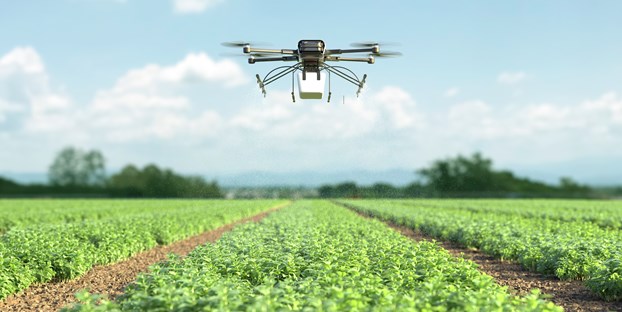
- Crop Growth Monitoring: The technology supports crop development tracking, crop health assessment, and yield prediction. In rural areas and large properties, it simplifies agricultural production monitoring, making it more accessible and comprehensive.
A Patent with Global Potential
This innovation opens the door to practical, global applications of drone technology in contexts that previously lacked access to precise and affordable measurement tools. NOVA IMS’s patent puts Portugal on the map of technological innovation with a solution that can easily scale across diverse international industries, from public to private sectors, helping transform drone-based data collection and analysis into a practical and accessible tool for all.


